

Double Bridge over Baker and Fifteenth Streets, circa 1880
Courtesy of the Burton Historical Collection, Detroit Public Library
The New York Times reproduced a detailed description of the bridge that originally appeared in the Detroit Post in July of 1874:
[T]he large gangs of hands at work, both upon the masonry and wood-work, indicate that their completion will be speedily accomplished. At the north side, on Fifteenth street, men are excavating for the foundations of ponderous stone abutments, and on the east side, Baker street, the massive hammered stones are under the hands of a score of stone-masons, being swung into position and cemented together to form the solid pile upon which the bridge is to rest for ages...
The Baker street bridge will be 304 feet in length, and the Fifteenth street bridge 336 feet. Each will be 41 feet in width, and 16 feet clear above the tracks. The carriage-way will be 29 feet in width, and on either side will be a sidewalk 6 feet wide for foot passengers...
Besides the massive stone abutments, the bridge will be supported by 120 wooden posts, 12 by 12 inches in size, four to each bent. (Source)
Click here to view the above photograph at full resolution. Examining the enlarged image in detail is the next best thing to having a window into Corktown of the 1880s.
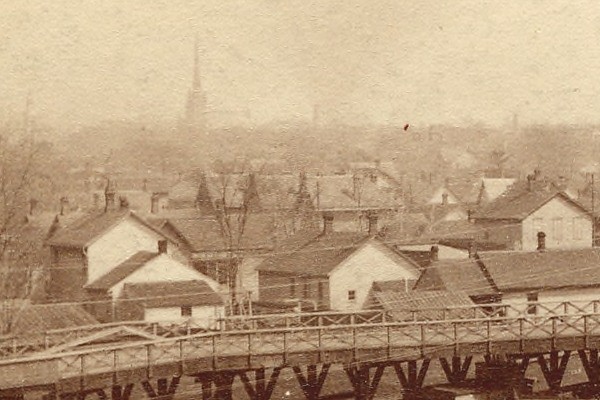
Detail from photograph above
Courtesy of the Burton Historical Collection, Detroit Public Library
The photographer was facing south-east when the photo was taken. The other bridge in the background is part of 14th Street.
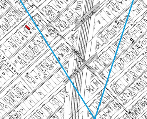
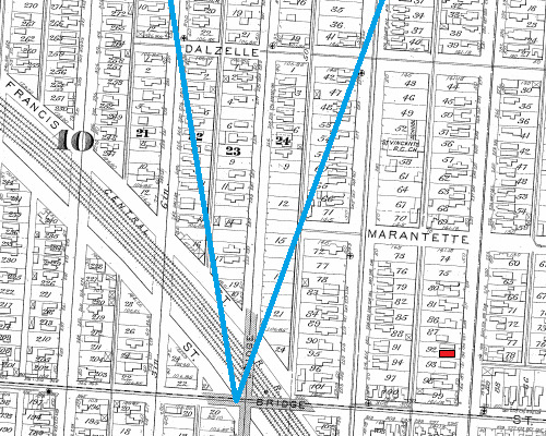
Approximate view imposed over an 1885 atlas of the city.
The Bechstein House is highlighted in red.
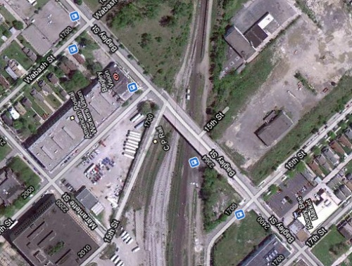
It's not easy to obtain a photograph from the same view today. A similar position to the 1885 photographer could be the roof of the building at 17th and Newark Streets. Today there is only a bridge for Bagley Street, which is what Baker is now called. Below is a recent satellite image of the area.
The next photograph of the bridge was taken from the Baker Street segment of the bridge looking north along 15th Street.

Courtesy of the Burton Historical Collection, Detroit Public Library
The church on the far left still stands at the corner of Rose and 17th Streets. The second church on the left was Immanuel Evangelical Lutheran Church at the corner of Pine and 17th Streets, which was attended by early inhabitants of the Bechstein house. The church was demolished in the 1960s to clear the way for Interstate 75.
It is also worth examining the full-resolution version of this image. Details of the bridge's construction described in the newspaper article above are easily visible:
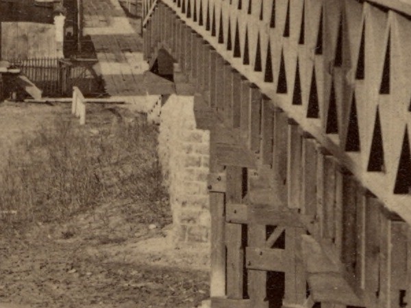
Detail from photograph above. Note the wooden sidewalk on 15th Street.
Courtesy of the Burton Historical Collection, Detroit Public Library
Approximate view imposed over an 1885 atlas of the city.
The Bechstein House is highlighted in red.
The photographer's perspective can be easily matched from the current Bagley Street bridge.

No comments:
Post a Comment