December 19, 2013

Corktown's Blurry Borders


People occasionally ask me--and I've seen the question come up in online discussion groups more than once--what the boundaries of Corktown are. The short answer is that there aren't any exact borders. A neighborhood is an idea that develops emergently, and it's based on the characteristics of its people, architecture, and geography. Whether an area is considered part of a neighborhood or not can change over time, or not even be completely agreed up on from the start. In All Our Yesterdays: A Brief History of Detroit (1969), authors Frank Bury Woodford and Arthur M. Woodford wrote:
Corktown existed almost as much in sentiment as in geography as its borders are rather vaguely defined. Some place it between Lafayette and Myrtle [now Martin Luther King Jr. Blvd.] with its eastern boundary at First Street and its western limit at Brooklyn or even beyond. But many an Irish-Detroiter born outside these boundaries claimed Corktown as his native hearth...


Old Corktown


The oldest published geographic description of Corktown that I have found appears in Silas Farmer's The History of Detroit and Michigan, published in 1884. He defined the neighborhood as:
the larger portion of the territory on Fifth and Sixth Streets, for several blocks each side of Michigan Avenue...
A profile of the neighborhood published in the June 19, 1919 edition of the Detroit Free Press explained that Irish immigrants in the early 19th century first settled along the river. Later, they were attracted to the west side after several farms were divided into individual lots for sale:
The Irish, who were home makers, crowded over into the new addition to the city and became almost the exclusive occupants of the territory between Third and Eighth streets and the river to the Grand River road. The concentration was south of Michigan Avenue.
When searching for more definite boundaries of early Corktown, the most common outline given is that which is described in the following example. On September 4, 1947, the The Detroit News published a question from a reader identified only as "F.R.", who wrote:
Ever since coming to Detroit people have been telling me of a neighborhood called Corktown. Could you give me some information about it? What were its boundaries? Did many prominent people come from there?"
The editor replied:
Detroit's Corktown had its origin in the disasterous [sic] potato famine in Ireland (1845-47), which forced much of the population to emigrate. Many of them found their way to Detroit and settled in the parish of the Holy Trinity Catholic Church, whose boundaries are considered to coincide with those of Corktown: Third avenue to the east, Grand River avenue and Ash avenue on the north, National avenue [now Cochrane Street] and Eleventh street to the west, and the Detroit River on the south. Within this area were some 1,000 Irish families, together with a few Scotch and German families. In 1938 George W. Stark wrote, "The old neighborhood's ancient glory was fast fading. The shady old streets had lost character. Famous families had moved away. Just the ghost of a tradition was left..." Promiment Corktownians include Gene Buck (song writer), Judge John J. Scallan, the Daniel J. Crowley family, Dinan brothers, and many others.
These borders are the same that appear in an illustration published in 1938 entitled "Animated map of Old Cork Town, 1849, the shrine of the Irish race, and the Kerry Patch of Old Detroit," by Denis Henry O'Meara.


Image courtesy of Ann Aldridge.

Deviations from this description can be found. Former Detroit mayor John C. Lodge (1862-1950) wrote in his memoir, I Remember Detroit (1949):
Another district which is still well remembered, although its old-time character is completely gone, is Corktown. It extended northward from Lafayette to about half a mile beyond Michigan Avenue. There was always a debate over its easterly boundary--whether it was First or Third Street. I always claimed it was First Street, and that all of the area westward of that thoroughfare belonged to Corktown.


Urban Renewal and the Western Annex


The shape of Corktown was drastically altered by urban revitalization in the mid-20th century. The construction of the Lodge Expressway and the demolition of "Skid Row" cleared everything east of Sixth Street. The West Side Industrial Project wiped out almost half of what was left of the neighborhood. Finally, in the 1960s, the construction of the Fisher Freeway and the leveling of houses for Tiger Stadium parking divided the last remnant of Corktown in half, with the northern part becoming known as the Briggs neighborhood.

In the midst of this destruction, Corktown's borders expanded westward. Expressways and industry had enveloped an area stretching from Sixth Street to Seventeenth Street, the breadth of which was characterized by Victorian working-class homes. Corktown, having lost its northern, southern, and eastern extremities, naturally melded with the adjacent and architecturally similar area to its west.

In the mid-1950s, when the Corktown Homeowners Association protested accusations that their neighborhood was a "slum," they made posters with photographs of the area showing a clean and functional neighborhood, including many buildings on Vermont, Wabash, and Fourteenth Streets. This indicates that these streets were by then embraced as part of the same neighborhood.
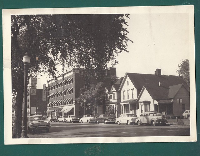

Fourteenth Street in 1954, by then considered part of Corktown.


The Historic Districts


When Corktown was listed on the National Register of Historic Places (NRHP) on July 31, 1978, it only included the part of the neighborhood east of Rosa Parks Boulevard:


Corktown Historic District, as described in National Register of Historic Places Inventory.

When Corktown preservationists fought for a city-recognized historic district (which offers more protection against demolition than the national designation), they attempted to include several blocks between Vermont and Fourteenth Streets. The local historic district was approved on December 24, 1984, but like the NRHP designation, it went no further than Rosa Parks Blvd. In fact, the two districts are nearly idenetical. Then-mayor Coleman A. Young stated that the western part of Corktown was of "dubious historic value" and castigated preservationists for "reckless designation of historic buildings and areas."


Note that in the map shown above, Michigan Central Station was considered to be part of Corktown by that point (early 1985). The train station was also a stop on the very first Corktown Historic Homes Tour in 1987. That same year, when the Corktown Citizens' District Council placed those now-familiar "Corktown: Detroit's Oldest Neighborhood" signs throughout the area, one was placed as far west as 16th Street and Michigan Avenue.

Corktown's so-called "western annex" finally won local historic designation on September 25, 1998. The Corktown Historic District, as now defined by the Detroit Historic Commission, is illustrated below:


The Corktown Historic District as recognized by the Detroit Historic Commission.


A New Definition


Obviously there is no one correct demarcation of Corktown. But it is worth attempting to create a definition that leaves room for interpretation while being restrictive enough to be meaningful: Corktown is the area west of downtown Detroit marked by a more or less continuous population of pre-World War I structures including Most Holy Trinity Church. Under this definition, today's Corktown is represented in the illustration below by the blue and green areas:


Click the image for a larger version.

Whether the areas in the yellow-shaded portion of this map should be considered part of Corktown is a matter of personal opinion. The north side has been separated from the core of the original neighborhood by freeways and parking lots, and like its southern neighbor, has expanded westward. Referring to this area as "North Corktown" seems to be a reasonable compromise that acknowledges its historical connection to Corktown as well as distinguishes its own unique character.

On the south side, every Victorian building within the West Side Industrial District was wiped clean off the map in the mid-1950s. Only the streets remain, and even those have been altered. However, if someone claims that Le Petit Zinc at 1055 Trumbull is located in Corktown, it would seem pedantic to disagree with them.

Finally, that brings us to "Corktown Shores", the name given to the area surrounding the revamped Green Dot Stables restaurant at the corner of Lafayette and Fourteenth Street. I'm pretty sure those guys were just kidding.

September 17, 2013

The Corktown House Moving Project of 1985

(Special thanks to Corktown Citizens District Council member Rebecca Robichaud for allowing me access to the organization's files on this subject!)


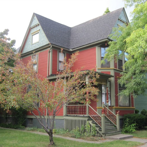
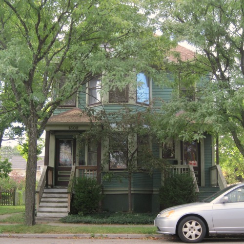
1301, 1309-17, and 1325 Bagley Street, Detroit.

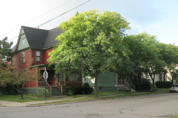
There is nothing out of the ordinary about these three houses southwest of Bagley and Brooklyn streets in Corktown. They all match the style and the age of the homes around them, each being over a century old.


1301, 1309-17, and 1325 Bagley Street, Detroit.

As it turns out, they have occupied this space for only twenty-eight years. As a creative method of housing infill, the city of Detroit moved these homes from areas where houses were being torn for Tiger Stadium parking in the 1980s. This is how they got there and where they came from.


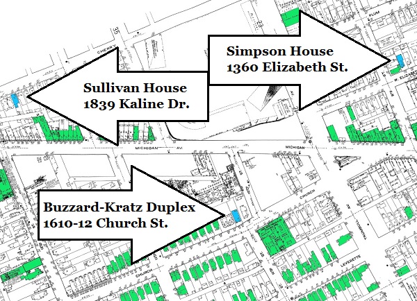
In this map of Corktown in 1921, green structures are those that are still
standing today, and the blue structures are those that were moved in 1985.


The Bagley Site Before 1985


An aerial view of Bagley and Brooklyn streets, circa 1980.
Photo courtesy of Bruce Beresh and Ben Newman.

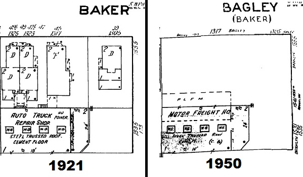
The new lots chosen for these houses once contained similar wood-frame houses, but they had been demolished by the 1950s as the neighborhood became increasingly industrialized.


Sanborn maps of Bagley Street, west of Brooklyn, in 1921 and 1950.

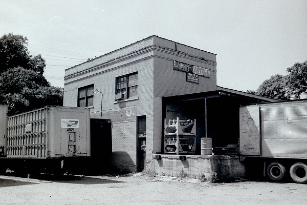
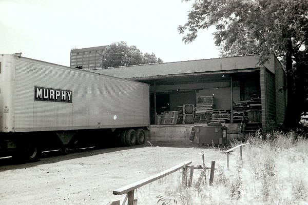
The rear of these lots still contained an old freight depot whose address was 1531 Brooklyn Street. This had been a commercial property since the Brooklyn Cartage Company was established here in 1908. In the 1920s, it was the service station for the Detroit branch of the Kelly-Springfield Motor Truck Company. The last business to operate here was Parent Cartage, Ltd. By the 1980s, the building was vacant and owned by the city.


Parent Cartage Ltd. at 1531 Brooklyn Street, 1976.
Image courtesy Michigan State Historic Preservation Office.


Parent Cartage Ltd. at 1531 Brooklyn Street, 1976.
Image courtesy Michigan State Historic Preservation Office.

Not everyone supported the demolition of this building. Some Corktowners wanted it renovated and used as a community center. The conflict resolved itself when the building caught fire and was no longer usable.
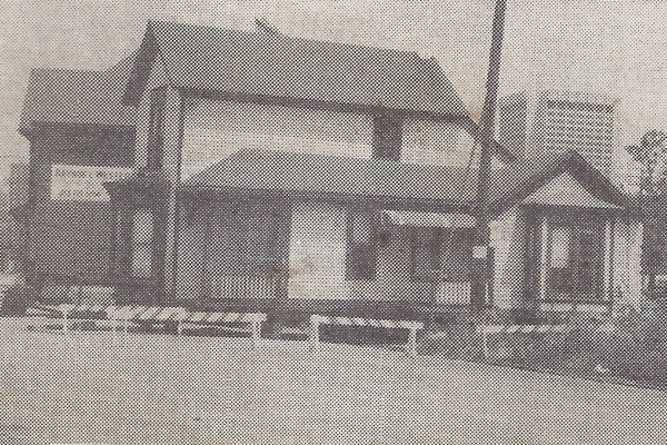

The Move


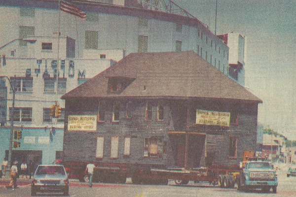
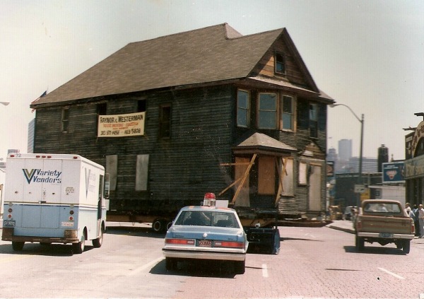
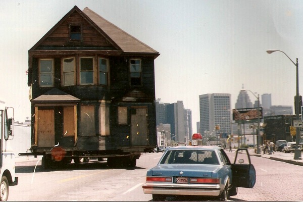
The Buzzard-Kratz duplex, being transported to its new home on Bagley Street.
Source: The
Detroit Free Press, July 25, 1985.

The 1985 Corktown House Moving Project was funded by the city of Detroit through a Community Development Block Grant from the U.S. Department of Housing and Urban Development. The city's Community and Economic Development Department reviewed bids and prepared contracts for the job, and coordinated with the Corktown Citizens District Council and the Corktown Non-profit Housing and Development Corporation.


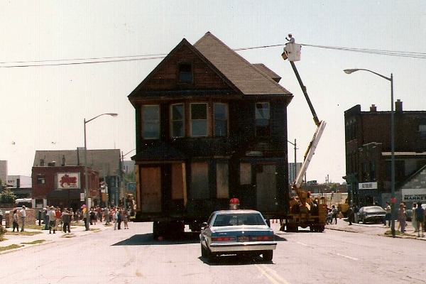
The Sullivan house coming down 12th Street on July 24, 1985.
Image courtesy of the Corktown Citizens District Council.

In addition to the purchase and moving of the houses, the $207,494 cost included a new basement for each house, repair of the old lots, utility hookups, new chimneys, landscaping, and a historically appropriate renovation for each exterior.

The moving and construction were coordinated by the Foremost Development Corporation. Resource Design Group, Inc. was the architect, and the Stanson House Moving Corporation trucked the homes to their new locations. These organizations had to coordinate with the local telephone and electrical companies in order to lift or temporarily reroute utility lines that would have blocked the movers' paths.


Utility lines were moved to accommodate the
Buzzard-Kratz duplex as it headed down Trumbull.
Image courtesy of Amelia Wieske and Paul Royal.

This complex operation had to be scheduled when the Tigers would not be playing at home. The date of July 24, 1985 was chosen, and all three houses were moved on the same day.


Image courtesy of Amelia Wieske and Paul Royal.

Once the old lots were vacated, they were used for Tiger Stadium parking. The Sullivan house on Kaline Drive was donated to the project by Frank and Mary Formosa, who moved to Dearborn in 1981. They retained ownership of the lot, half of which had already been used for parking for many years. The Buzzard-Kratz duplex on Church Street was purchased from Rose Gale, Vince Gale, Joe Gale, and Mary Gale Micallef, who grew up in the home. The lot was among several that they operated as parking lots. The Simpson house on Elizabeth Street was purchased from Irene Sember, who lived next door at 2100 Eighth Street and used several adjacent lots for stadium parking.

The Buzzard-Kratz duplex making a wide right turn onto Michigan Ave. from Tenth St.
Image courtesy of Amelia Wieske and Paul Royal.

Once the exterior renovations were completed, the next step was to find new owners to renovate the interiors. Each home was sold for $6,500 to buyers who could demonstrate that they could complete the job in one year, but it doesn't appear that any of them were finished on time. The first purchasers were Paul and Mary Grima (1301 Bagley), David M. Brown (1309-1317 Bagley), and Gary J. Kaufman (1325 Bagley).


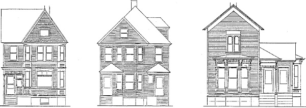
An elevation of what the completed project would look like, circa 1984.
Image courtesy of the Corktown Citizens District Council.


HISTORIES

* * * * *


The Michael & Mary Sullivan House

Current location: 1301 Bagley St. (Lot 1, Block 59, Baker Farm)
Original address: 315 Cherry St. (Lot 3, Block 5, Thompson Farm)
Subsequent addresses:
  • 1839 Cherry St., following 1921 address change
  • 1839 Kaline Drive, following August 2, 1970 renaming after Al Kaline.

Michael Sullivan was born in County Cork, Ireland in December 1847. He immigrated to America at a young age with his parents, Dennis and Catherine Sullivan. Around 1878 he married Mary Evans, born in Michigan in 1858 to Irish immigrants. Michael and Mary Sullivan had at least seven children, whom Michael supported with his work as an iron molder at the Russell Wheel and Foundry Co.

The city issued the building permit for this house to Michael Sullivan on October 29, 1895. The estimated cost to build it was $1,500. Michael and Mary Sullivan would spend the rest of their lives here. Michael passed away June 3, 1920, followed by Mary, who died some time in the late 1920s.

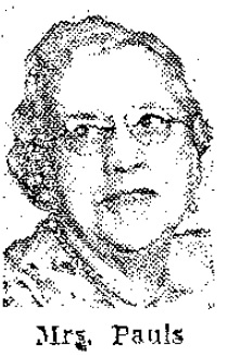
On January 27, 1910, one of the Sullivans' daughters, Lillian (born August 1882), married steamboat captain Frederick Henry Pauls (born June 14, 1884 in Danbury, Ohio). At first Mr. and Mrs. Pauls lived in a home on Ash Street. But since Captain Pauls' work had him away so often, the couple moved in with Lillian's parents. Fred and Lillie Pauls had two children, but neither survived infancy.

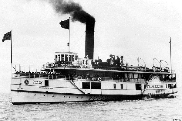
From 1911 through 1919, Captain Pauls was the master of the Frank E. Kirby of the Ashley & Dustin line, which ran between Detroit and Sandusky, Ohio daily. The ship was named for her architect, who also designed the Columbia and Ste. Claire (aka the "Bob-Lo Boats").


The steamer Frank E. Kirby. (Source.)


After the Frank E. Kirby was sold, Captain Pauls found work on the Mackinac, and ultimately became captain of the brand new Greater Detroit, the largest passenger vessel on the Great Lakes at the time.


The steamer Greater Detroit. (Source.)


In August of 1931, Captain Pauls was removed from command of the Greater Detroit due to a drinking problem. Two weeks later, on September 5th, Pauls' body was discovered in the basement of his home by his brother-in-law, Frank Sullivan. Pauls was found to have committed suicide by wrapping his head in a towel soaked in chloroform. His wife had been away on vacation when the incident occurred.

Mrs. Lillian G. Pauls lived at 1839 Cherry Street--later renamed Kaline Drive--until her death on January 22, 1954.


Mrs. Lillian G. Pauls (1882-1954).
Source:
The Detroit News, 5 May 1952


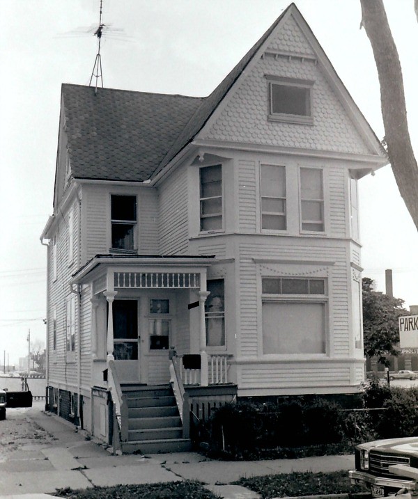
1839 Kaline Drive in its original location in 1976.
Image courtesy of the Michigan State Historic Preservation Office.


1839 Kaline Drive in its original location in 1976.
Image courtesy of the Michigan State Historic Preservation Office.


The Buzzard-Kratz Duplex

Current location: 1309-17 Bagley St. (Lot 2, Block 59, Baker Farm)
Original address: 54-56 Church St. (Lot 14, Block 82, Woodbridge Farm)
Subsequent address:1610-12 Church St., following 1921 address change

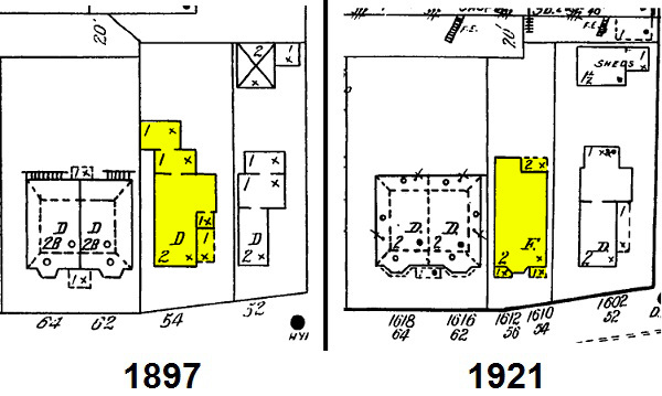
This two-family home appears to have been built around 1905. It came from a lot on Church Street where a previous single-family home was constructed about 1874. Although I have not been able to locate the building permit data, I believe this house is not the same as the one built in 1874 for two reasons: 1) The address 56 Church doesn't appear in the directories until 1906 (prior to that, only 54 Church appears); and 2) The Sanborn maps before and after 1905 clearly show different houses:


The duplex now faces 180 degrees from its original orientation, so that the lower original address of 54 (1610) Church St. now corresponds to the higher new address of 1317 Bagley, and the higher original address 56 (1612) Church St. address is now the lower new address of 1309 Bagley.


Irvin & Agnes Buzzard


The first occupants of 54 Church Street--the downstairs unit--were Irvin and Agnes Buzzard, first listed at this address in the 1906 directory.

Irvin George Buzzard was born in Groveland Township, Michigan on April 28, 1856. As a young man he worked as an apprentice at the Phoenix Iron Works. Later, he found employment as a marine engineer. On November 17, 1881, he married Agnes Cecelia Gleason. She was born in Michigan in April of 1859. They had two children: Harold G. (1883-1909) and Gleason M. (1898-1979), the latter of whom Mrs. Buzzard birthed at the age of 39.

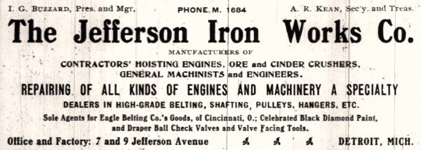
In December of 1905, Mr. and Mrs. Buzzard co-founded the Jefferson Iron Works Company. Mr. Buzzard was the company's president and manager, and Mrs. Buzzard was vice-president. Their co-founders were Alfred R. Kean (the company's secretary and treasurer) and his wife, Sarah Kean.


Mr. and Mrs. Buzzard lived in this house only though 1908. By 1909, it was occupied by a postal clerk named Frederick S. De Galan. Irvin Buzzard lived until 1924, and Agnes Buzzard until 1931. Their company still exists, now operating out of Ferndale.


Oscar & Clara Kratz


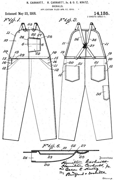
56 Church Street--now 1309 Bagley, the upstairs unit--was first occupied by Oscar Eugene Kratz and his first wife, Clara. By the time they lived in this house on Church Street, Mr. Kratz was a machine operator for Hamilton Carhartt Inc., which at the time was located directly behind his house. By 1908, he had worked his way up to factory superintendent. Mr. Kratz also designed clothing for Hamilton Carhartt, and his name appears on some of their design patents.


(Source.)

In 1909, Mr. Kratz had become suspicious of his wife and hired a private detective to follow her. He and the detective agreed to meet at a hotel cafe where he would point out his wife. When Mr. Kratz walked in, he found the detective sitting with Mrs. Kratz. "What are you doing with my wife?" he asked, according to a newspaper account of the incident (Detroit Free Press, 23 Mar 1909). The detective had no idea that the woman he was talking to was Mrs. Kratz, who told the detective that she was unmarried. Mr. Kratz obtained a divorce soon after. On November 9th of that same year, Oscar Kratz married Nanno L. Hunt, and they would have at least two children together. Mrs. Nanno Kratz passed away in 1934. In 1941, Oscar Kratz married a third time, to Miss. Ada C. Floyd.

Mr. Kratz lived in the duplex on Church St. through 1908. In 1909, he was listed at an address on Columbia Street.

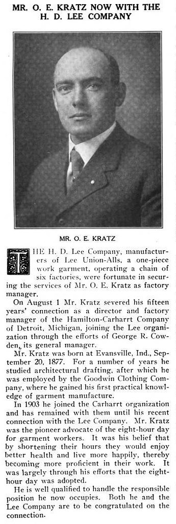
In 1917, Mr. Kratz left Hamilton Carhartt and moved to Kansas City, Missouri to take up a position with the H. D. Lee Mercantile Company, manufacturers of workers' clothing, known today as Lee Jeans.


(Source.)

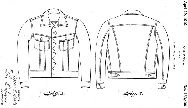
Kratz continued to design clothing for Lee, including this jean jacket in the 1940s.


(Source.)

Kratz's jean jacket is now known as the Lee 101-J. It has been called an "archetypal" and "iconic" jean jacket, and is still in production.


(Source.)

Oscar E. Kratz passed away on January 13, 1969 in San Diego, California at the age of 92.


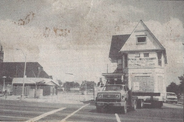
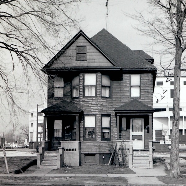
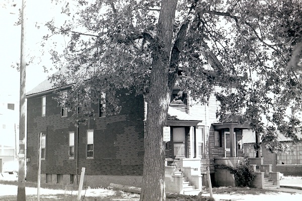
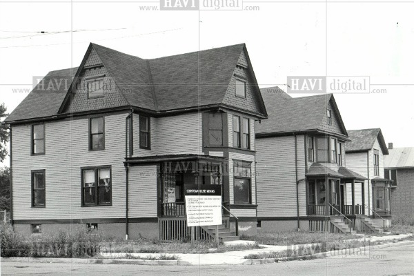
The Buzzard-Kratz duplex in its original location on Church Street in 1976.
Image courtesy of the Michigan State Historic Preservation Office.


The Buzzard-Kratz duplex in its original location on Church Street in 1976.
Image courtesy of the Michigan State Historic Preservation Office.


The Buzzard-Kratz duplex, being escorted down Michigan Ave. on July 24, 1985.
Image courtesy of Amelia Wieske and Paul Royal.


The William T. Simpson House

Current location: 1325 Bagley St. (Lot 3, Block 59, Baker Farm)
Original address: 228 Orchard St. (Lot 8, Block 88, Woodbridge Farm)
Subsequent address:
  • 412 Elizabeth St., following c. 1912 union of Orchard and Elizabeth streets
  • 1360 Elizabeth St., following 1921 address change

William Thomas Simpson purchased the original lot that this house stood on from Samuel Zug on September 25, 1883 for $850. A home first appeared at this address in the city directory in 1884.

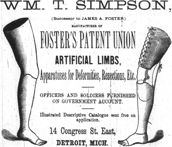
Simpson was born in Ontario in January 1839. He moved to Rochester, New York in 1860 where he learned the art of artificial limb making from Dr. Douglas Bly. During the Civil War he moved south in order to supply maimed soldiers with his products. In 1875, Simpson accepted the invitation of James A. Foster of Detroit to join him in the business of artificial limb manufacturing. Foster died in July 1881, leaving Simpson his appointed successor. Simpson's business prospered, filling orders throughout the United States and Canada.


William Simpson's first wife, Lettie Moitmoir Simpson, passed away on February 25, 1893, at the age of 41. Mr. Simpson married again, on October 30, 1894, to Clara Beuttner. Neither of Simpsons' marriages produced any children.


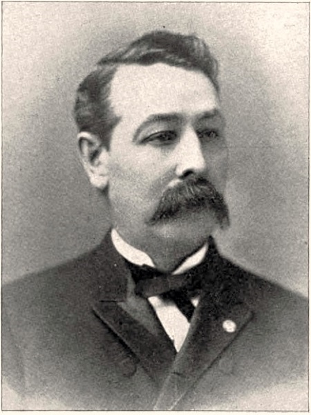
William Thomas Simpson (1839-1915) (Source.)

Mr. Simpson operated his business downtown until 1912, when he moved it to Corktown. The final address of his shop would have corresponded to 1342 Michigan Avenue, a space that is now a vacant lot. He lived in his home on Elizabeth Street until his death on December 27, 1915. Mrs. Clara Simpson subsequently spent the rest of her life in this home, passing away on February 26, 1939.


The Simpson house on cribbing in preparation to be moved.
Image courtesy of the Corktown Citizens District Council.


The Simpson House almost at its new location on Bagley Street.
Image courtesy of the Corktown Citizens District Council.


Although this project was slow to progress through the government's bureaucracy, it was ultimately a success. These homes and their tangible connection to Corktown's history were saved from being destroyed to make room for gravel parking lots. Old houses injected new life into a formerly industrialized block begging to be reactivated as a residential area. In this instance, the taxpayers' money was well-spent.

A project similar to this one would make sense in parts of the city where one can find blocks consisting of only one or two lonely houses. In light of the Corktown relocation project, and the Detroit Future City report calling for the deactivation of under-populated neighborhoods, moving houses out of such areas to more stable communities seems like a superior alternative to demolition, especially if the homes happen to be well-cared for, historic, or architecturally significant.


All three houses just after having been set in their new locations. (Source.)

September 3, 2013

Moore House - 1366 Bagley


1366 Bagley Street, Detroit.
Photo courtesy of Blake Almstead and Joshua Clark.

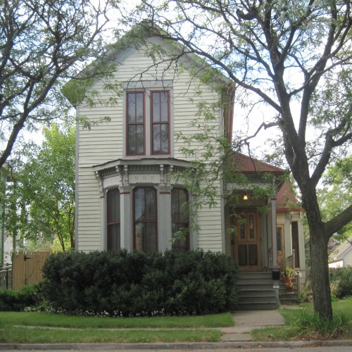
This quintessential mid-19th century worker's cottage has stood at the corner of Bagley and Eighth Street for at least 139 years. Addressed as 70 Baker Street early in its history, it has been home to more than a dozen working class families in its life.


When was it built?


It's not certain when 70 Baker Street (now 1366 Bagley) was constructed. One potential source of information could be a map drawn by New York cartographer Henry Hart in 1853, indicating the location of every existent building in Detroit.


Detail from Henry Hart's 1853 map of Detroit.

There is only one problem. This house was literally a few feet outside of the city limits when that map was drawn. The Baker farm had been annexed by the city in 1849, but this house stands just within the former Woodbridge farm, which wasn't annexed until 1857. Below is a comparison of this block as it appears on the 1853 Hart map and an 1885 real estate atlas. Due to the blurriness of the 1853 image, I've outlined the structures and property borders to make them more visible.


The block containing 70 Baker St. as shown on the 1853 Hart map and an 1885 atlas.

It appears that the house to the right of 70 Baker Street is indicated on the 1853 map. These two houses are very similar in appearance, being almost mirror images of each other. It seems reasonable to believe that they were built at the same time. However, the earliest known city directory listing for 70 Baker appears in 1874. I combed through the 1870 census for this area and checked those names and addresses against the city directories, but I could not find any indication that this house existed at the time.

Although the property wasn't formally platted until 1858, this doesn't necessarily preclude the possibility of the house existing before then. Joseph Kingston, for example, was listed on Baker Street on the Woodbridge farm one year prior to platting.

The strongest indication that the house could predate 1874 is that the property was sold in 1865 for $450, and again in 1871 for $1700. Was this 375% increase due to the construction of a house on the lot, or was there simply an increase in demand for property in a rapidly growing city?


Owners--1850 to 1950


The lot beneath this house was part of the William and Juliana Woodbridge farm, which became part of the City of Detroit on February 12, 1857. Mr. and Mrs. Woodbridge submitted a plat plan of their land to Wayne County on September 14, 1858. They had both passed away by 1861, leaving many unsold lots to their children.


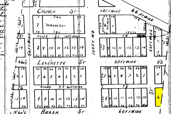
Detail of 1858 plat of Woodbridge farm. 1366 Bagley/70 Baker stands on block 58, lot 6.

After platting:

  • July 22, 1865--Samuel Sullivan purchased the lot from Juliana Trumbull Woodbridge Backus, daughter of William and Juliana Woodbridge, for $450.
  • July 29, 1871--Following the death of Samuel Sullivan in 1870, John Sullivan sold the lot to William Moore for $1,700.
  • June 16, 1904--William Moore died, leaving the property to his wife, Margaret.
  • February 7, 1922--After Margaret Moore's death in 1920, her heirs agreed that her son John W. Moore would own this lot, and he agreed to pay them $600 for the property.
  • May 6, 1952--John W. Moore died in 1946, followed by his last surviving sibling Katherine in 1950. The relatives who inherited the property subsequently sold it on a land contract to Nora Kelly.

Because the Moore family owned the property for 81 years (longer than anyone else), and because they may have been the ones to build the house, I suggest calling it the Moore house. William Moore was born in February of 1818, and his wife, Margaret Sullivan Moore, in March of 1830--both in Ireland. They married there on March 8, 1848, and very soon afterward immigrated to Canada. They remained there until about 1870, when they came to Detroit. William Moore's occupation was always listed simply as "laborer". When he died in 1904 at the age of 86, his death certificate indicated that he was the father of seven children, five of whom were living. Margaret Moore survived her husband by sixteen years, finally passing away on February 12, 1920 at the age of 89. The son who inherited the property on Baker Street was John W. Moore, born March 1, 1868 in Essex County, Ontario. He never married or had children.

None of the owners of the home before Nora Kelly used it as their own residence. Had it first been owner-occupied, the city directories might have been used to help determine a more precise date of construction.


Renters--1874 to 1951


1874-1877 -- William and Anna Dick

William Dick, a chair maker, was born in Prussia in 1850. His family immigrated to the United States when he was still an infant. His wife, Anna Pip, was born in Michigan to Prussian parents. They had two children while living in this house--Agnes in 1874 and Caspar in 1877.

1878 -- Edward H. Day

Day was born in Elyria, Ohio in 1853. He was a sales agent and a bachelor at the time he lived on Baker. In July of the following year, he married Mary L. Little, a native of Oswego, New York.

1879-1880 -- Robert E. and Ellen Cuppage

The directories list Robert Cuppage, a telegraph operator for Western Union, as the occupant of this home. The census, however, only lists his sister Ellen Cuppage and a boarder named Julia Rouen. Ellen and Robert were born in Canada in 1857 and 1858, respectively.


70 Baker Street in the 1884 Sanborn map of Detroit.

1881-1887 -- Gore A. Stacey and Family

Gore A. Stacey was born around 1833 in Ireland and worked as a baggage handler for the rail road. By the time he and his wife Anne moved to 70 Baker Street, they had at least six children: John (b. 1857), twins Gore Jr. and Anne (b. 1861), William E. (b. 1866) and Joseph H. (b. 1868). Gore Stacey died at home on March 14, 1885. A notice was published in the Detroit Free Press two days later, but his name was misspelled as "Tracy".


The Stacey family lived at this house through 1887.

1888-1893 -- Squire and Catherine Emick

Squire Henry Emick and his wife Catherine, originally from Indiana, came to Detroit around 1886 with three sons, Charles, Morris and Emery. Squire worked as an express messenger. At 70 Baker Street, Catherine gave birth to a daughter, Edith.

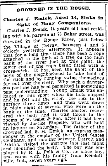
On June 14, 1893, the Emicks' eldest son, Charles, drowned in the Rouge River at the age of 14:


By the following year, the Emick family had moved to another home in the neighborhood.

1894-1898 -- Thomas and Theresa Sage

On June 22, 1893, Thomas J. Sage, a bartender, married Theresa A. Manning--both were first-generation Americans born to Irish immigrants. The year after their marriage, they moved into 70 Baker Street, where they had two daughters, Marie and Mildred.

1899-1912 -- Charles and Helen Johnston

In 1899, Helen "Nellie" Horn was listed at this address in the city directory. On June 28 of that year, she married electrician Charles James Johnston, who moved in with her immediately afterward. They were both 24 years old at the time, and both originally from Michigan. The 1900 census shows two borders living with them--Joseph Leahy, a printer; and John Leahy, a student.

At 70 Baker Street, the Johnstons had two children--Madeline (born circa 1901) and Edgar (born July 10, 1902).


Charles and Helen Johnston, with their children Edgar and Madeline.
Image courtesy of Blake Almstead and Joshua Clark.


Edgar Johnston in front of 70 Baker Street, circa 1910.
Image courtesy of Blake Almstead and Joshua Clark.


1913-1915 -- James Fox, clerk


1916 -- William Ditmus, printer


1917 -- Ernest and Caroline Noyes

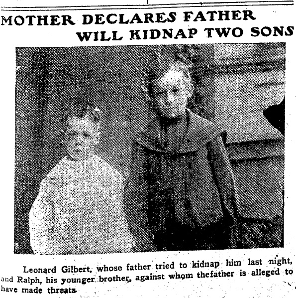
Ernest Noyes, a laborer, was born in New York in 1869. After his first wife died in 1912, he married Caroline McKenzie, who had been married twice before. She brought into the family two surviving sons from her first marriage, Leo and Ralph Gilbert, born in 1899 and 1901, respectively. The photograph below was printed in the Detroit Free Press about the birth father of these two boys attempting to kidnap them in 1907. The boys did live with their mother when she resided at 70 Baker Street.


Caroline Noyes died of sepsis at Harper Hospital on July 23, 1917 at the age of 40. The following year, on May 12, Erneset Noyes died at the Wayne County Poor House from locomotor ataxia at the age of 49.

1918-1920 -- Foster Curtis Lenderbeck

Foster Lenderbeck was the second husband of Caroline McKenzie (see above). He was born in Canada in 1865 and immigrated to the U.S. in 1894. He worked as a teamster for a storage company. The 1920 census indicates that he lived with May Irwin (a servant) and Frank and Lucinda Reid. Mr. Reid was also a teamster.

On October 23, 1920, Foster Lenderbeck died at 70 Baker Street from lobar pneumonia. He was 55 years old.

1921 -- Hercules (Ercole) and Harriet Barbara

Hercules Barbara, a mechanic, was born in 1874 in Sfax, Tunisia. His parents were Maltese, but worked in Sfax as olive oil merchants. Hercules immigrated to the U.S. in 1915. In 1920 his wife, Harriet, and their two children (all also born in Malta) joined him in Detroit. [Thanks to Teresa Taylor for the updated information!]

1922 -- (Vacant)


1923-1928 -- James and Donnie Hogue

Miss Donnie Stone married James Hogue, a street car conductor, in Detroit in 1920. Both were originally from Kentucky. Mr. Hogue passed away May 13, 1925 at the age of 41, and Mrs. Hogue stayed in the house for another four years.

1929-1951? -- Joseph and Mary Sultana

Joseph and Mary Sultana were both born in Malta--Joseph in 1895, and Mary in 1899. Joseph came to the United States in 1921, followed by his wife four years later. By the 1940 census, they had had at least seven children.

The Sultanas are listed at this address in the city directories through 1941, but the availability of city directories after that year is sporadic. They may have lived there until the home was sold in 1951.


1366 Bagley is on the far left in this 1954 photo, partly cropped out.


Owners 1952-Present


Nora Kelly

This home and two adjacent houses were sold collectively to Mrs. Nora Kelly and other investors on May 6, 1952. After the contract was paid in full, the properties were divided and Mrs. Kelly became the sole owner of 1366 Bagley on September 19, 1961.

Nora Ellen (Daly) Kelly was born in Detroit to Jeremiah and Ellen Daly on February 16, 1896. Her father was an Irish immigrant, and her mother was born in England. On October 22, 1918, she married Michael J. Kelly, who had immigrated from Ireland a few years before. Michael Kelly passed away on April 5, 1945 at the age of 52.


1366 Bagley in 1976. Image from Michigan State Historic Preservation Office.

Nora Kelly lived at 1366 Bagley at least through 1973, when she is listed at that address in the city directory for that year. She owned the home until her death on May 24, 1981. If she lived in this home until her death, then she occupied it for 29 years, longer than any other resident.


1366 Bagley in 1979 following a renovation funded
by the Holy Trinity Nonprofit Housing Corp.
Photo courtesy of Blake Almstead and Joshua Clark.


Daniel & Kathleen O'Neill

On September 14, 1982, the estate of Nora Kelly sold the house to Daniel M. & Kathleen A. O'Neill for $4,500. They only appear to have lived in the house for a brief time.


Frances (Lubben) Elkins

The O'Neills sold the house to Frances Lubben for $8,000 on October 25, 1985. She does not appear to have lived in the home.


James R. and Duane Shore

Frances Lubben, who by this time was Mrs. Frances Elkins, sold the home to James R. and Duane Shore on June 17, 1998. James Shore presumably purchased the home on a land contract, as he was involved in renovating the home as early as 1988.


This photo of James Shore in front of 1366 Bagley appeared in an
article about Corktown in the
Detroit Free Press on May 5, 1988.


1366 Bagley in 1990. Photo courtesy of Blake Almstead and Joshua Clark.


Carol Brown

On June 17, 2000, Duane Shore quit-claimed his interest in the house to James Shore, who on June 30 of that year sold it to Carol Brown for $60,000.


Blake Almstead & Joshua Clark

Josh and Blake moved into the Moore house in August of 2011 and are currently working to preserve it.


Photo courtesy of Blake Almstead and Joshua Clark.


* * * * *

Miscellaneous notes about previous research on this house.

A previous researcher named this home the Bushy House after James Bushy, who supposedly purchased the property in 1845. However, the land owned by Bushy was actually an adjacent lot on the Baker farm. Bushy never owned the land beneath this house. It has also been claimed that this house appears in an 1853 atlas, but as you have seen, this is not the case.

A photograph of 1366 Bagley that appears in the Michigan State Historic Preservation Office's files refers to it as the "Kelley-Porritt" house. Kelley might refer to Nora Kelly, and Porritt to Elizabeth Porritt. However, Mrs. Porritt lived at 64 Baker Street, not 70 Baker. Interestingly, Elizabeth Porritt was attempting to divorce her husband Joseph at the time on the grounds that he was a habitual drunkard. The divorce was appealed all the way up to the Michigan Supreme court, which denied her a divorce on the grounds that she knew her husband was a drunkard when she married him. In any case, there is no evidence that Mrs. Porritt lived in this house.

Finally, if any researchers wish to help confirm that the Moore house was built prior to 1874, be advised that the address numbering system in Corktown was changed between 1868 and 1869. If the Moore house stood prior to 1869, it would have had a number lower than 70 Baker before that point. There was a "70 Baker prior" to 1869, but the address number was changed to 92 afterward.